OvitalMap8.7.5
Publisher Description

OvitalMap is a map browser developed by Beijing Ovital Software Co.,Ltd. based on Google API, supporting offline views of Google Map, satellite map and terrain map, as well as voice navigation.
OvitalMap has the following features:
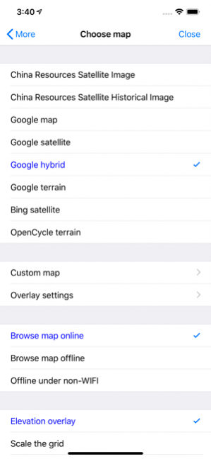
1、 Support a variety of well-known maps
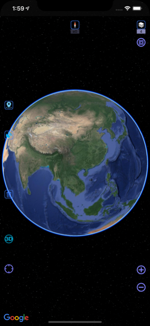
At present it supports Google map, Google satellite map and Google terrain map. The user can easily switch between these maps. The maps can be downloaded for offline applications to save 3G traffic.
2、 Route search
Google API offers a search engine to choose the best route for you. It will find an optimum solution for your travel, either by walk,bus or driving.
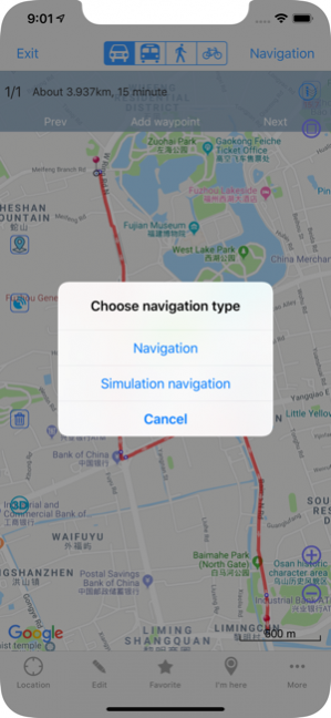
3、 Interactive voice navigation
There will be voice navigation for the walk or driving route suggested by the system. The location of friends will be shown on the map dynamically so that you can know where they are and don’t need to worry losing their positions any more. The system can highlight moving tracks of more than one friend with lines of different colors.
4、 Information search
The API search engine will offer information about your location, roads, and buses, as well as hotels, entertainment, banks, restaurants, supermarkets, gas stations, parking lots, and tourist attractions nearby a certain position. Catering and entertainment providers can also be sorted by price or customer ranking.
5、 Location sharing
You can share your location at a certain moment with selected relatives or friends so that they will know your position on the map.
6、 Communication with friends
When you are using the system to chat with a friend (just like using QQ or MSN), you can insert a location tag, travel solution, or a map created by yourself. After receiving the insertmessage, he can have it shown on his map by a simple click. Thus, if you know the position of your friend, you can draw a route on the map and send it to him. The route will be shown on his map for him to follow.
7、 Track record
The system can record your tracks, which can be saved and sent to friends.
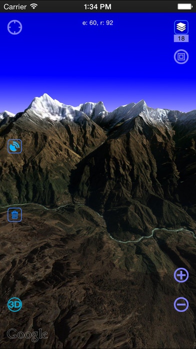
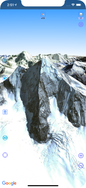
8. Elevation data service, the Cloud of Ovitalmap integrate SRTM3 elevation data around the world. You can quickly see about any place’s altitude in the world. We also can direct output the contour line in 10 meters on the satellite map, which helps you directly see the elevation data on satellite map.
9. Real 3D map, which is similar to Google Earth, combines the satellite map and elevation data, and can show the real terrain of the world.
-----------------------------------------------------------
Continued use of GPS running in the background can dramatically decrease battery life.Dec 22, 2020 Version 8.7.5
Fix bug that attachment cannot be displayed on map
About OvitalMap
The company that develops OvitalMap is Beijing Ovital Software Co.,Ltd.. The latest version released by its developer is 8.7.5. This app was rated by 42 users of our site and has an average rating of 3.6.
To install OvitalMap on your iOS device, just click the green Continue To App button above to start the installation process. The app is listed on our website since 2020-12-22 and was downloaded 8,517 times. We have already checked if the download link is safe, however for your own protection we recommend that you scan the downloaded app with your antivirus. Your antivirus may detect the OvitalMap as malware if the download link is broken.
How to install OvitalMap on your iOS device:
- Click on the Continue To App button on our website. This will redirect you to the App Store.
- Once the OvitalMap is shown in the iTunes listing of your iOS device, you can start its download and installation. Tap on the GET button to the right of the app to start downloading it.
- If you are not logged-in the iOS appstore app, you'll be prompted for your your Apple ID and/or password.
- After OvitalMap is downloaded, you'll see an INSTALL button to the right. Tap on it to start the actual installation of the iOS app.
- Once installation is finished you can tap on the OPEN button to start it. Its icon will also be added to your device home screen.
Program Details
System requirements
Download information
Pricing
Version History
version 8.7.5
posted on 2020-12-22
Dec 22, 2020 Version 8.7.5
Fix bug that attachment cannot be displayed on map
version 8.7.4
posted on 2020-12-17
Dec 17, 2020 Version 8.7.4
Bug fixes and function optimization
version 8.7.1
posted on 2020-11-10
Nov 10, 2020 Version 8.7.1
Bug fixes and function optimization
version 8.7.0
posted on 2020-10-23
Oct 23, 2020 Version 8.7.0
1. VIP adjustment
2. Some bug fixes and function optimization
version 8.6.6
posted on 2020-09-30
Sep 30, 2020 Version 8.6.6
Bug fixes and function optimization
version 8.6.2
posted on 2020-09-16
Sep 16, 2020 Version 8.6.2
1. Other bug fixes and function optimizations
version 8.5.3
posted on 2020-08-05
Aug 5, 2020 Version 8.5.3
Bug fixes and function optimization
version 8.5.2
posted on 2020-07-29
Jul 29, 2020 Version 8.5.2
Bug fixes and function optimizations
version 8.5.0
posted on 2020-07-22
Jul 22, 2020 Version 8.5.0
1. The newly added model object is used to save 3d model data (DAE format file)
2. Fix the bug that cannot jump in 3D
3. Other bug fixes and function optimizations
version 8.4.8
posted on 2020-06-28
Jun 28, 2020 Version 8.4.8
1. Shape support random colors
2. Other bug fixes and function optimizations
